
SEAWORKS… Depth Perception
Seaworks is lead by a Professional Engineer and Hydrographer certified by the National Society of Professional Surveyors/Hydrographic Society of America (formerly ACSM). This is issued by a national Certification Board in order to ensure hydrographic work is only performed by the most highly qualified individuals. All of Seaworks’ Professionals have a strong background in hydrography, having performed thousands of hydrographic surveys throughout the Great Lakes, US coastline, and inland river systems.
Seaworks is a HUBZone Certified Small Business
TECHNOLOGY
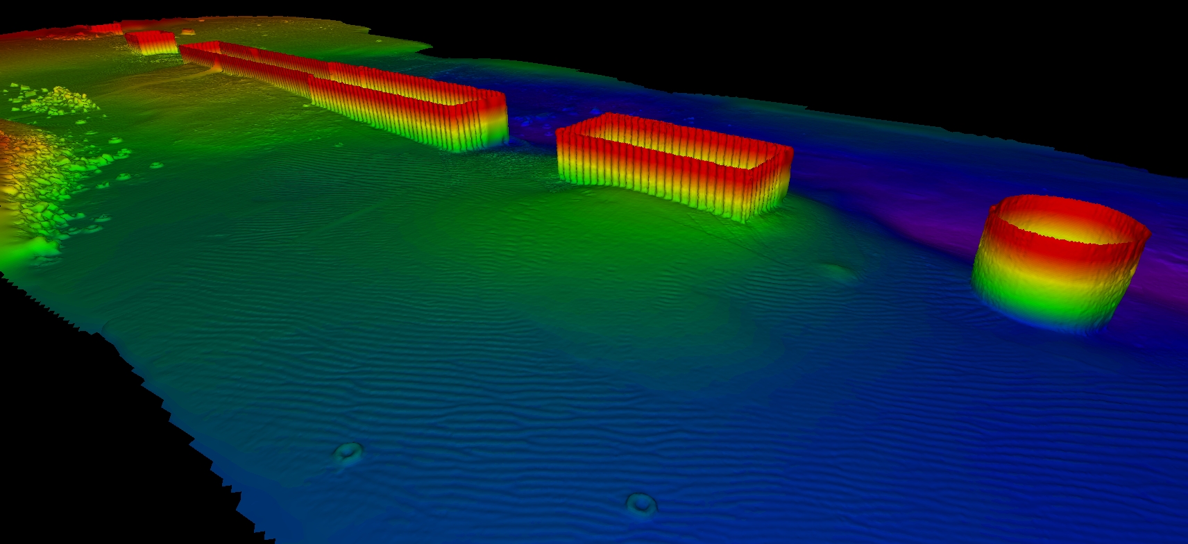
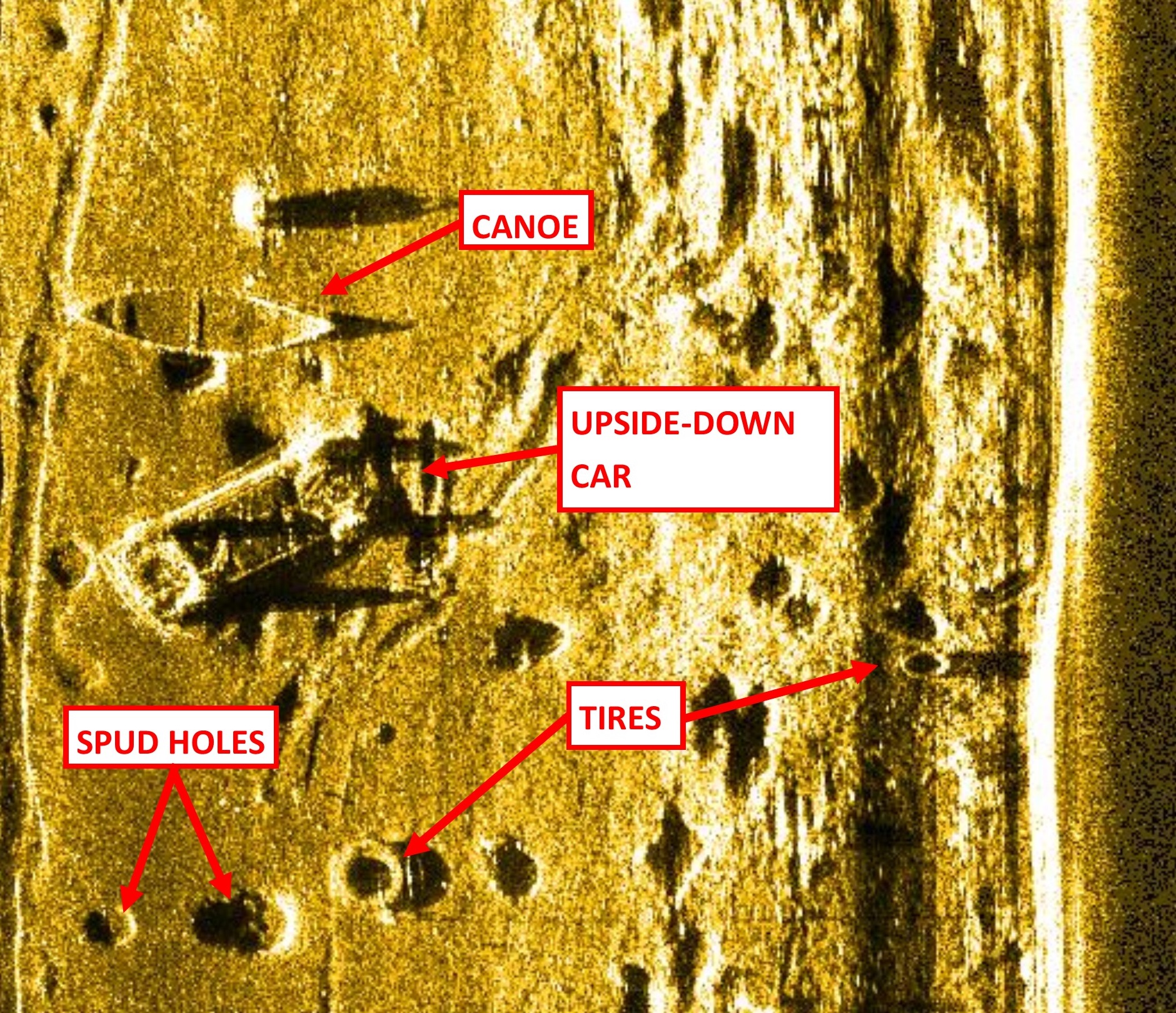
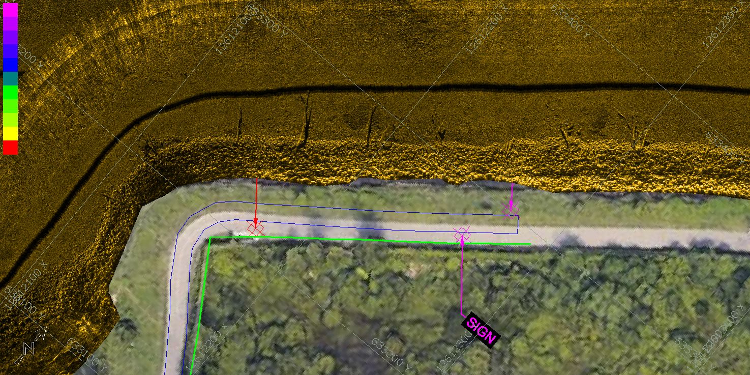
SONAR
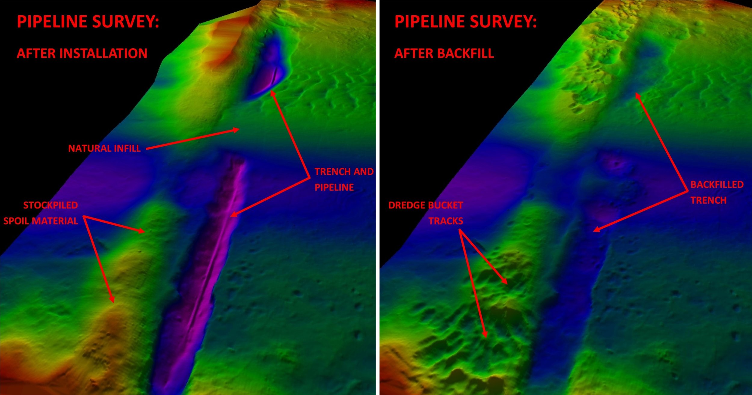
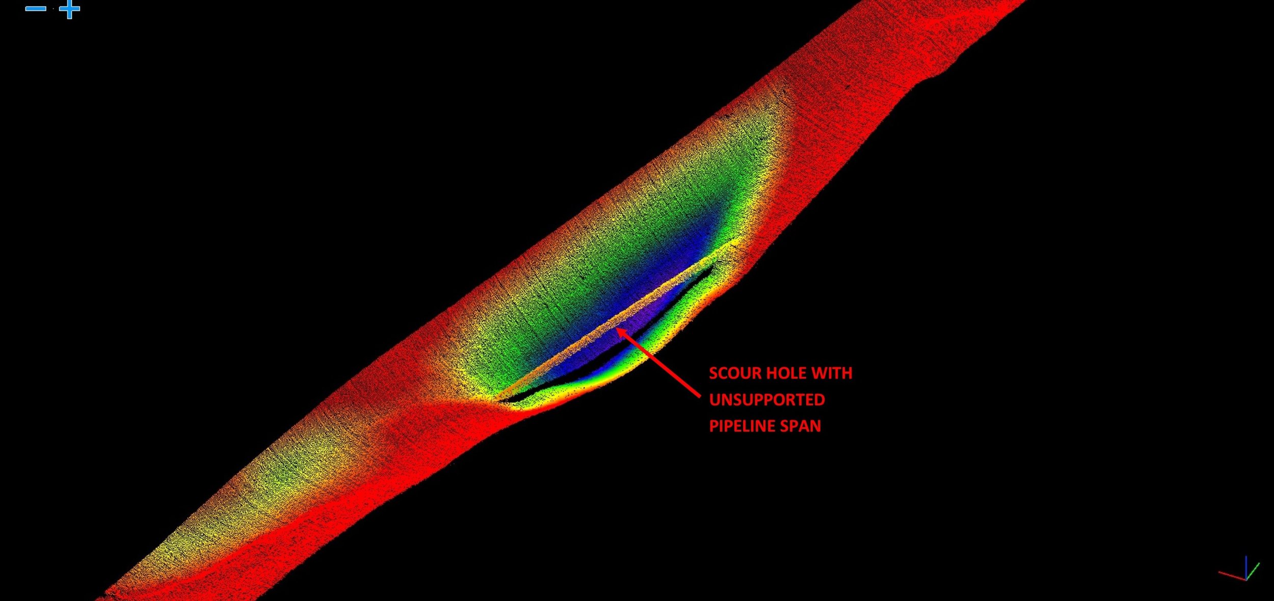
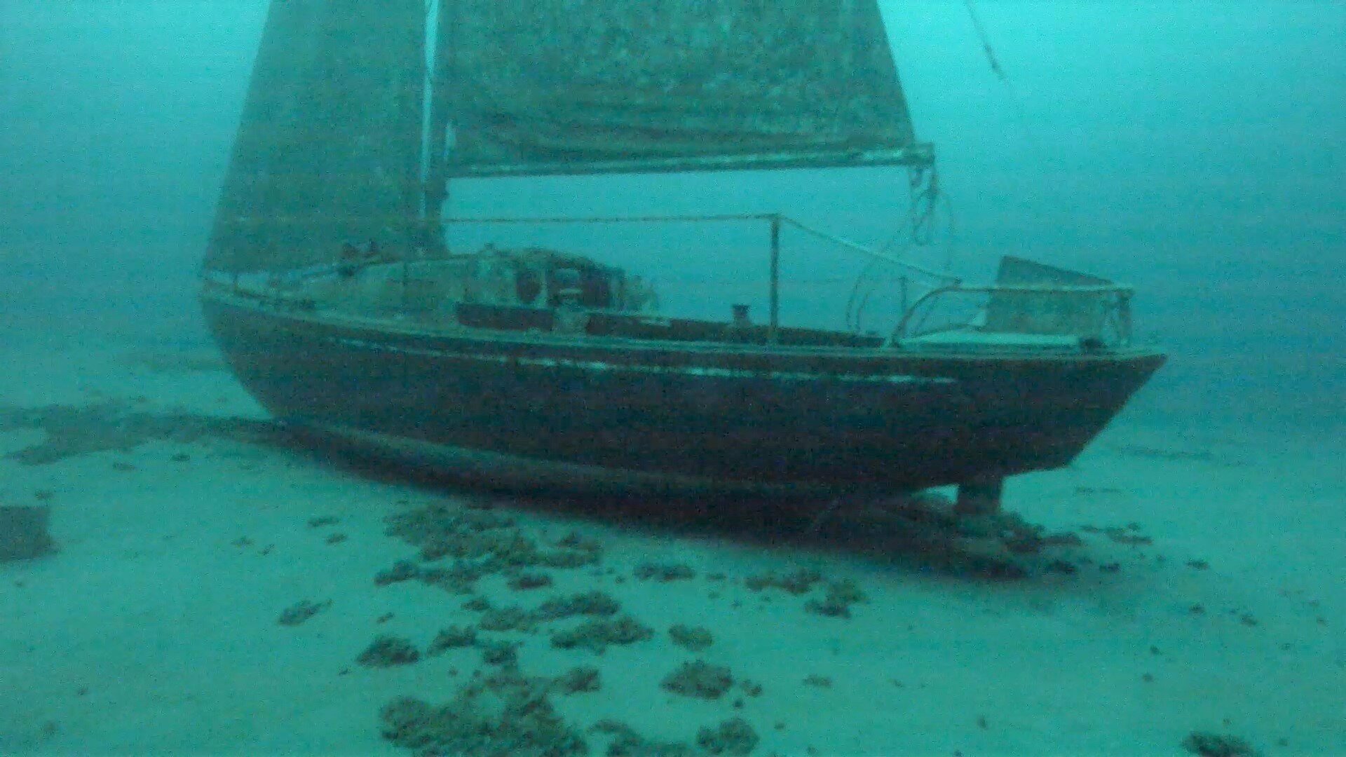
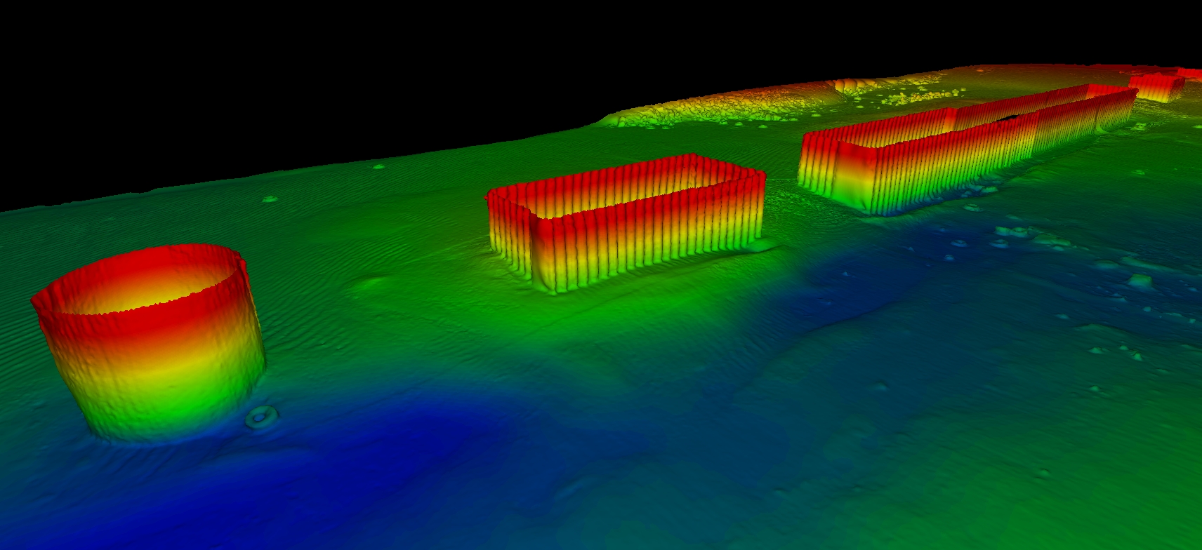
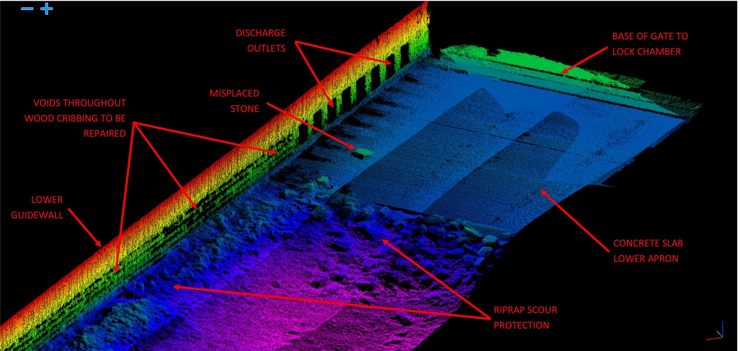
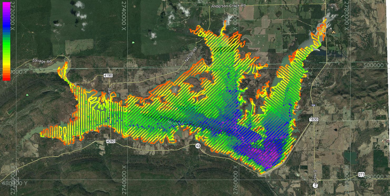
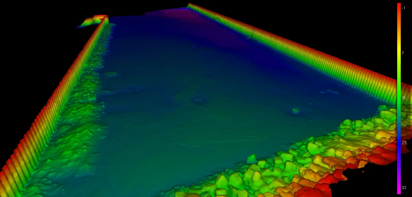
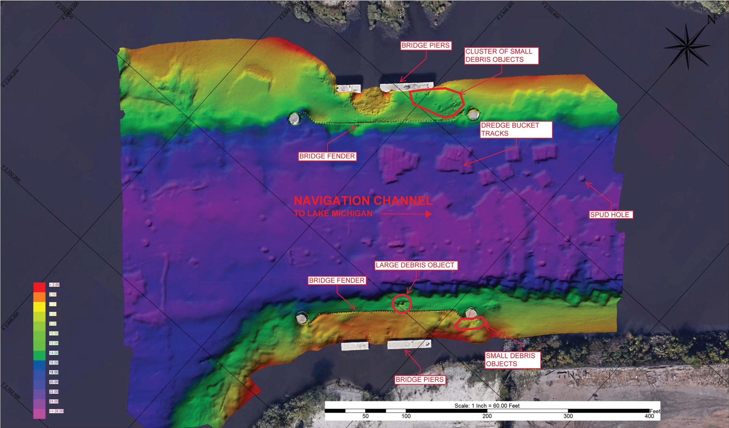
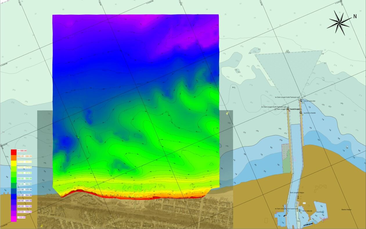
Seaworks is fully equipped with the best hydrographic systems available, including dual-frequency side scans and ultra-high resolution multibeam systems. Seaworks is able to scan the bottom in incredible detail, making these the ultimate technologies for subsurface inspection, object location, and as-built surveys.
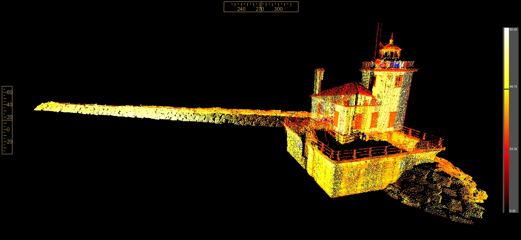
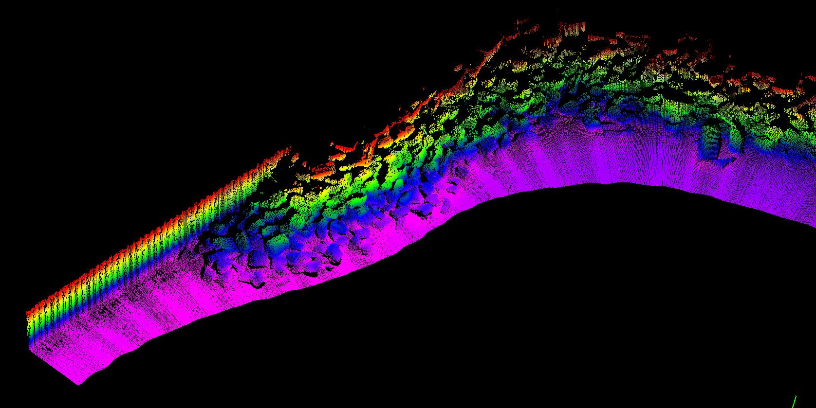
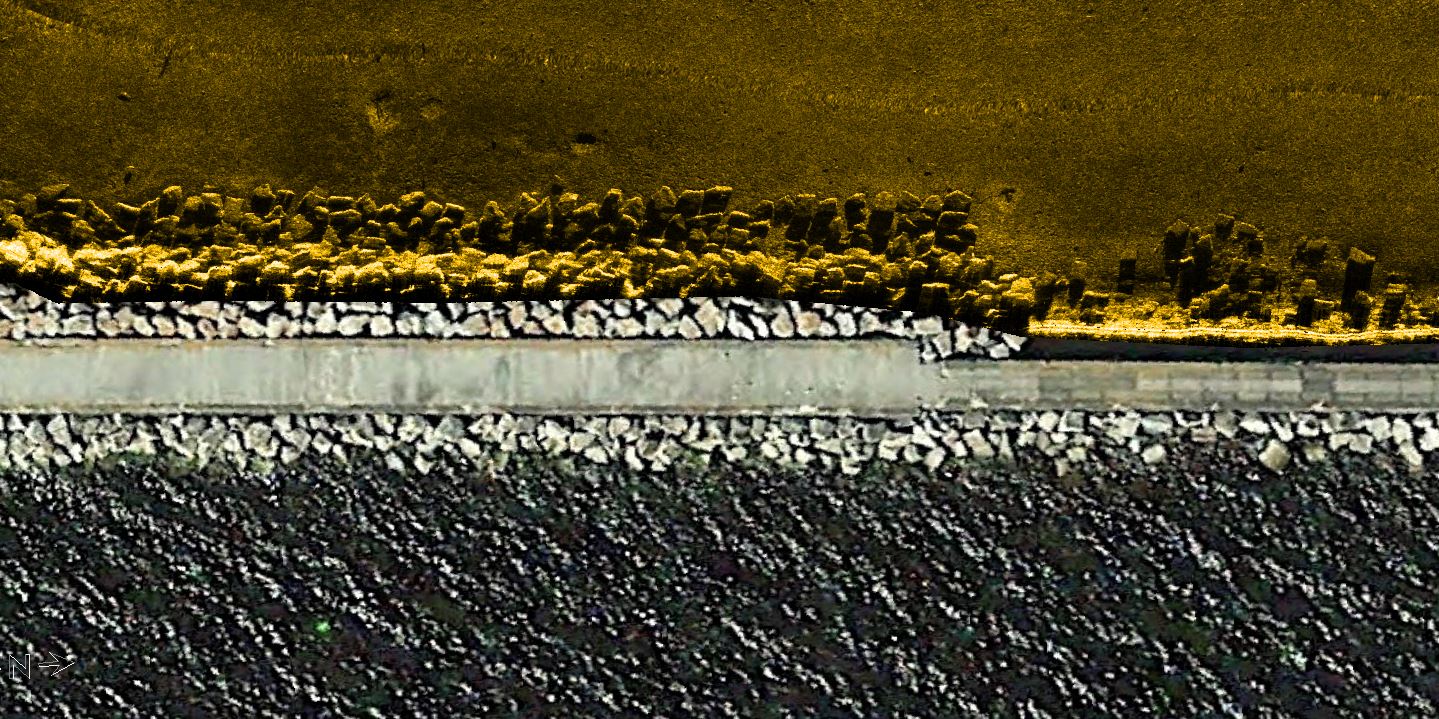
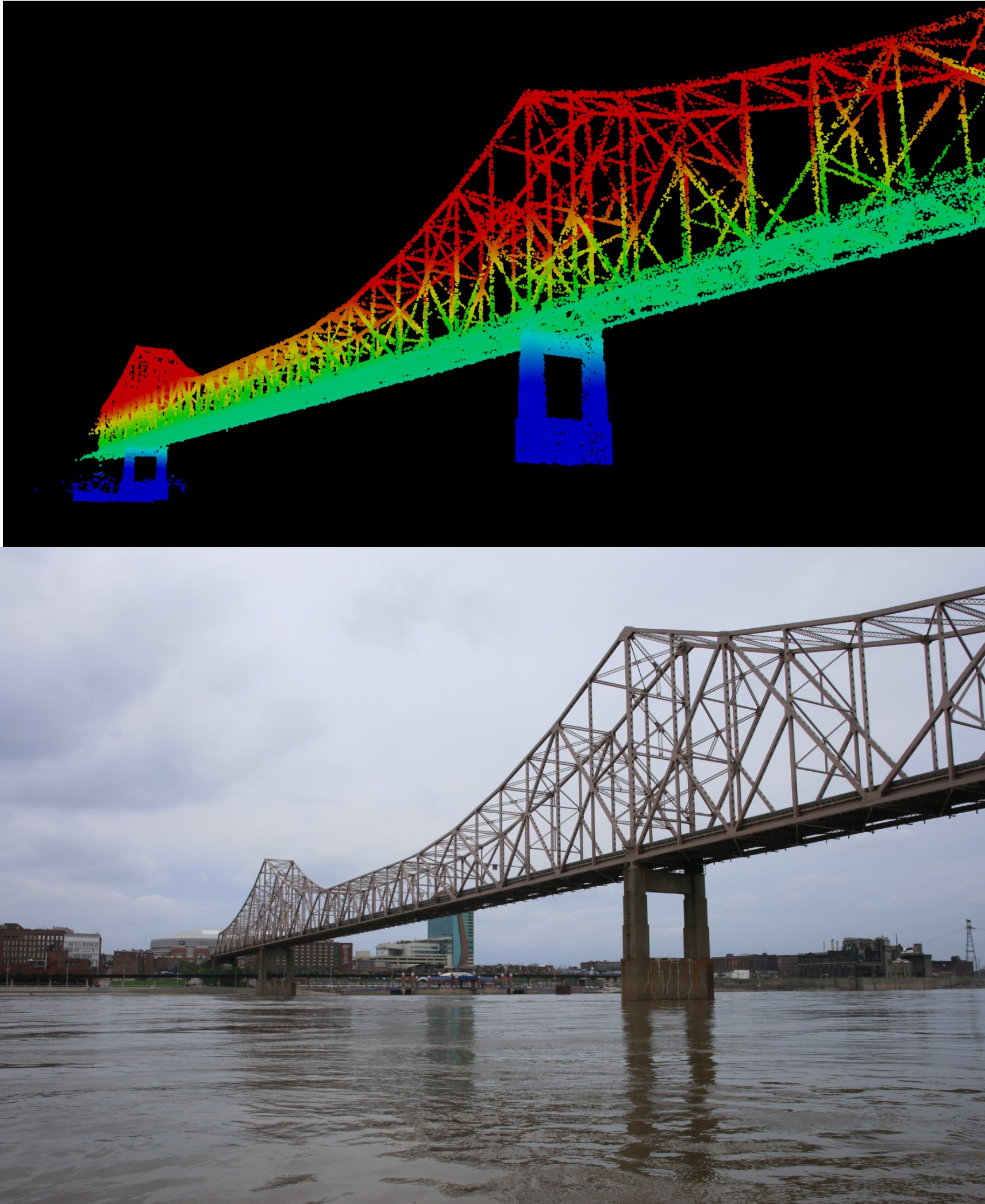
MOBILE LIDAR
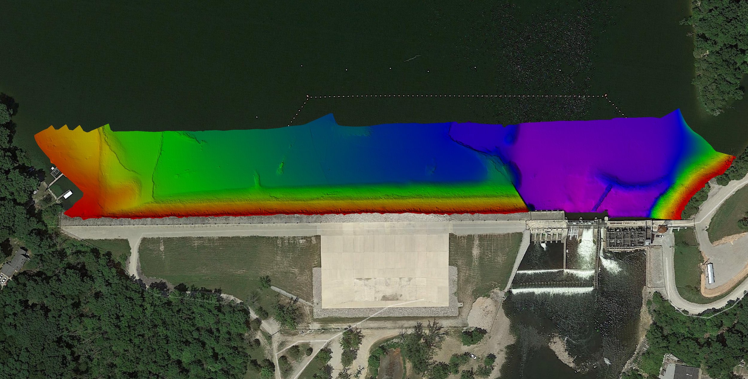
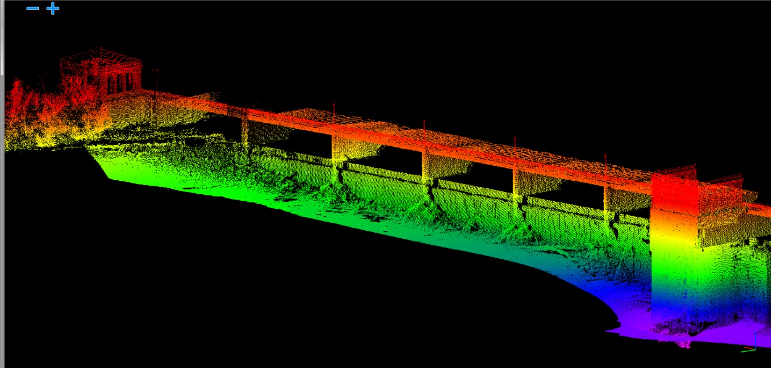
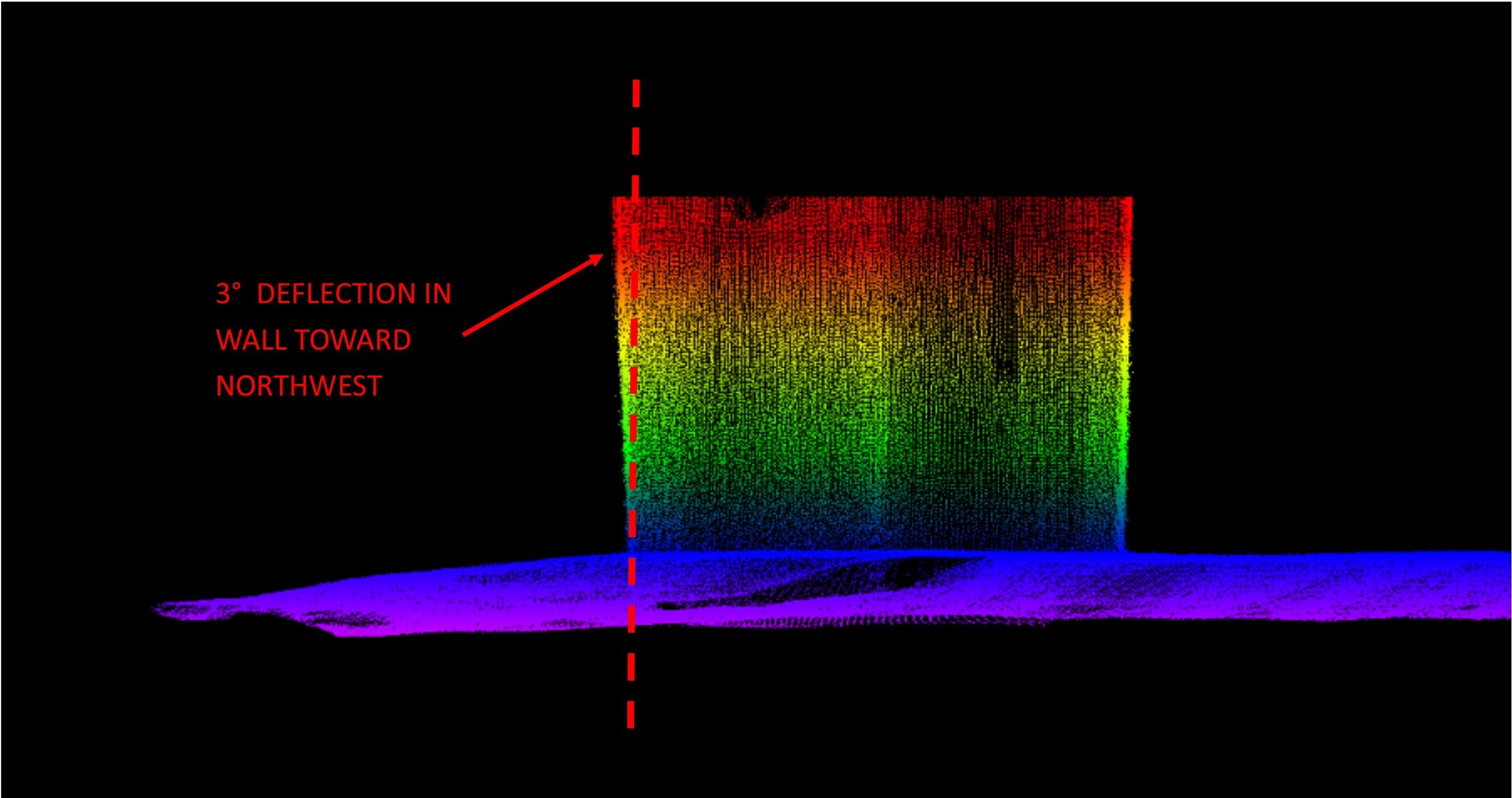
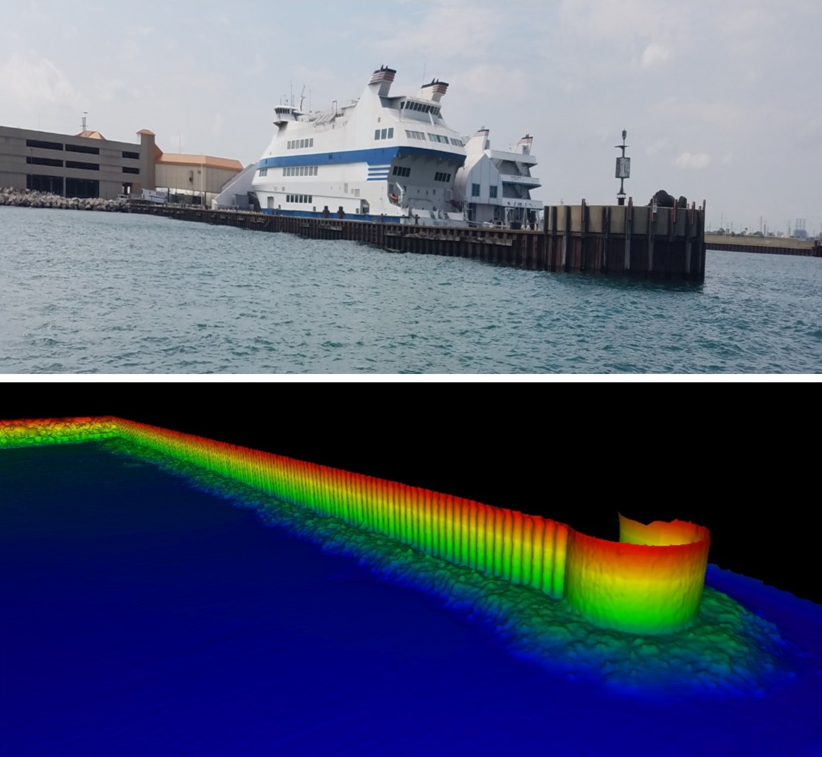
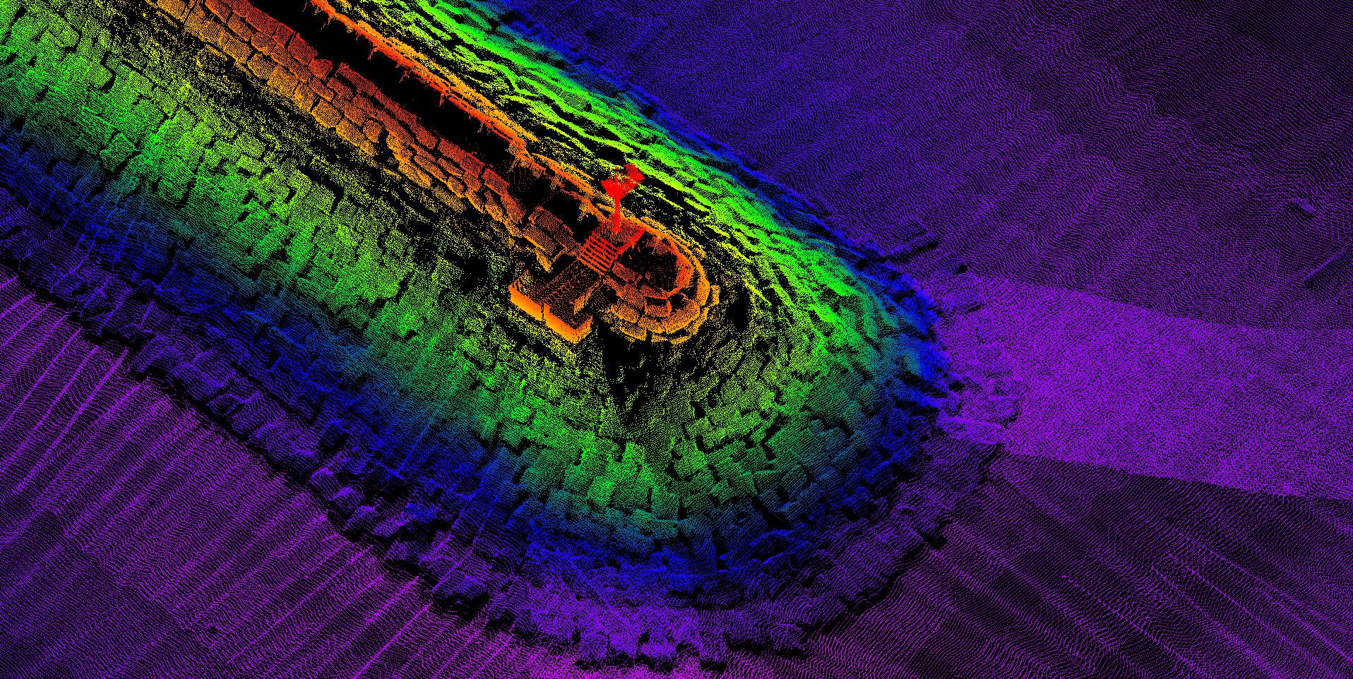
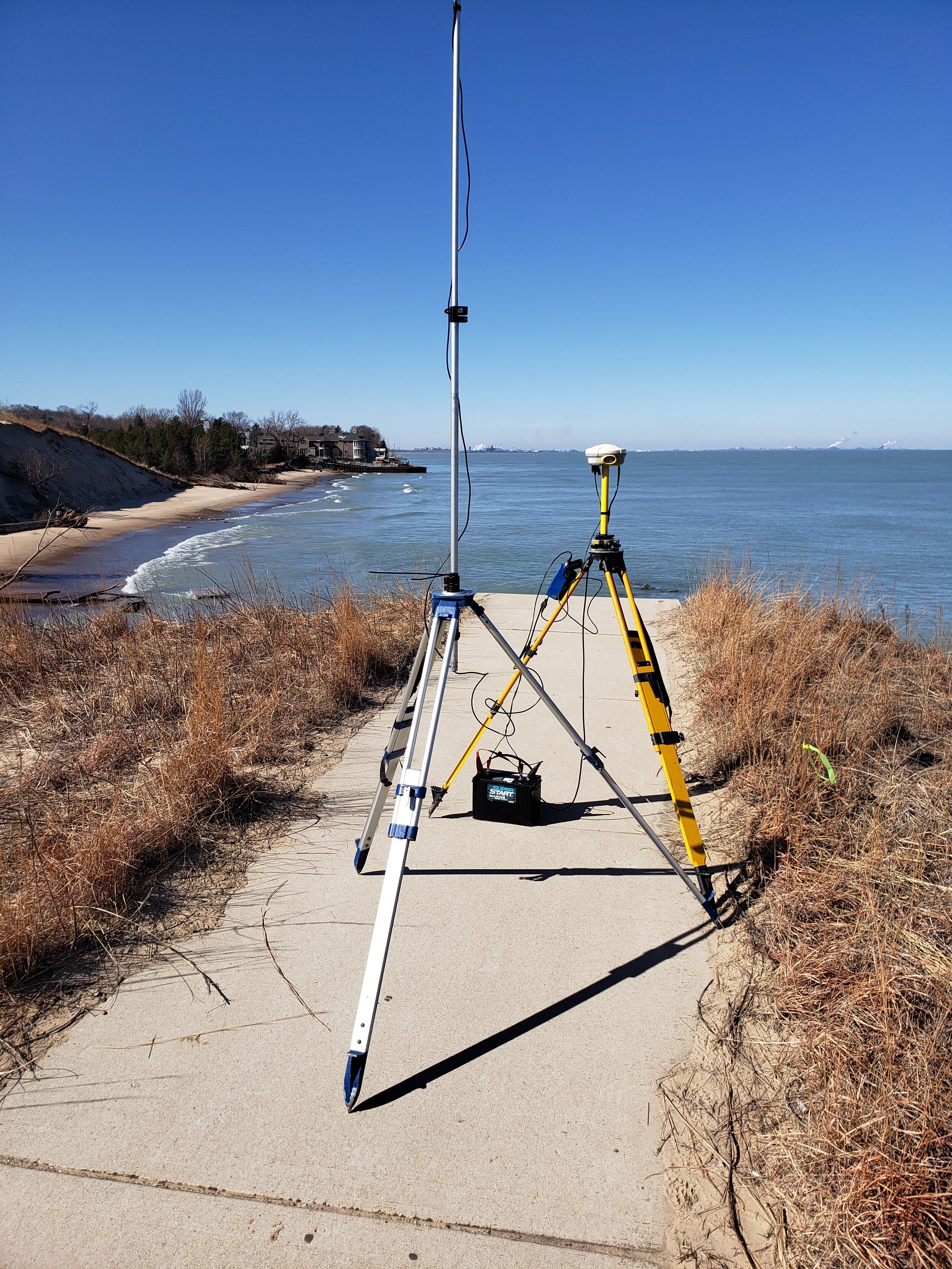
Additionally, Seaworks’ fleet includes a combination mobile LiDAR/multibeam sonar equipped survey vessel, generating a high-resolution point cloud above and below the waterline simultaneously. Using a laser module scanning at a rate of 36,000 points per second at 2” accuracy, Seaworks collects bank and structure data more quickly, at a higher resolution, and a lower cost than a dedicated land survey crew.

EQUIPMENT
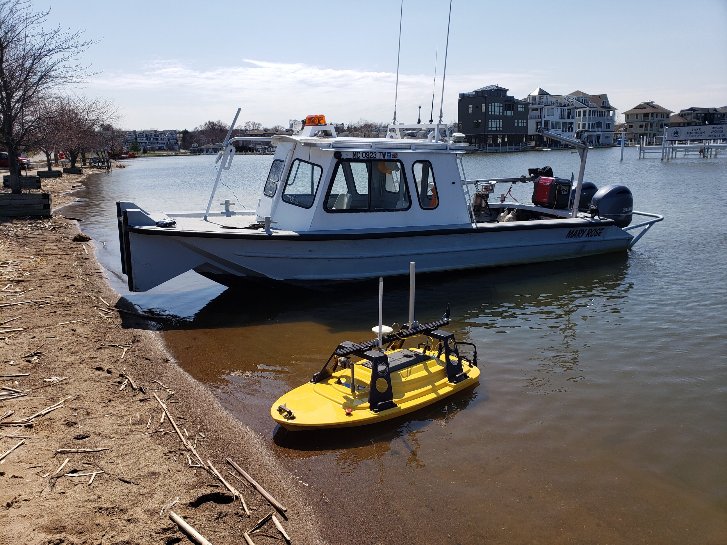
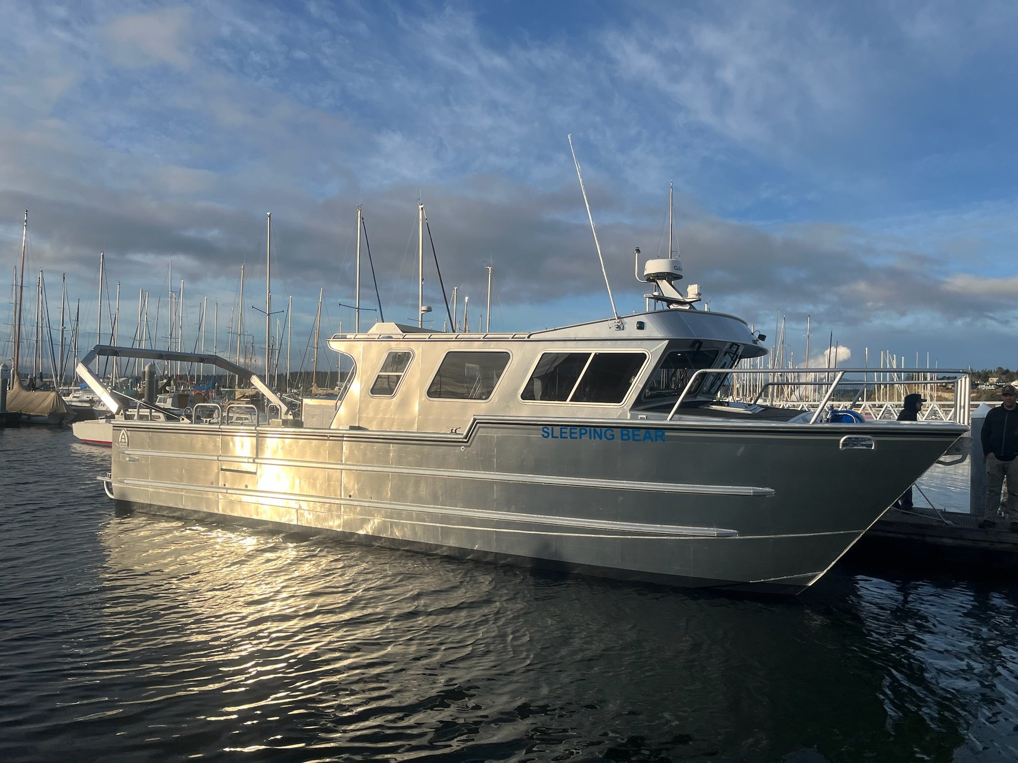
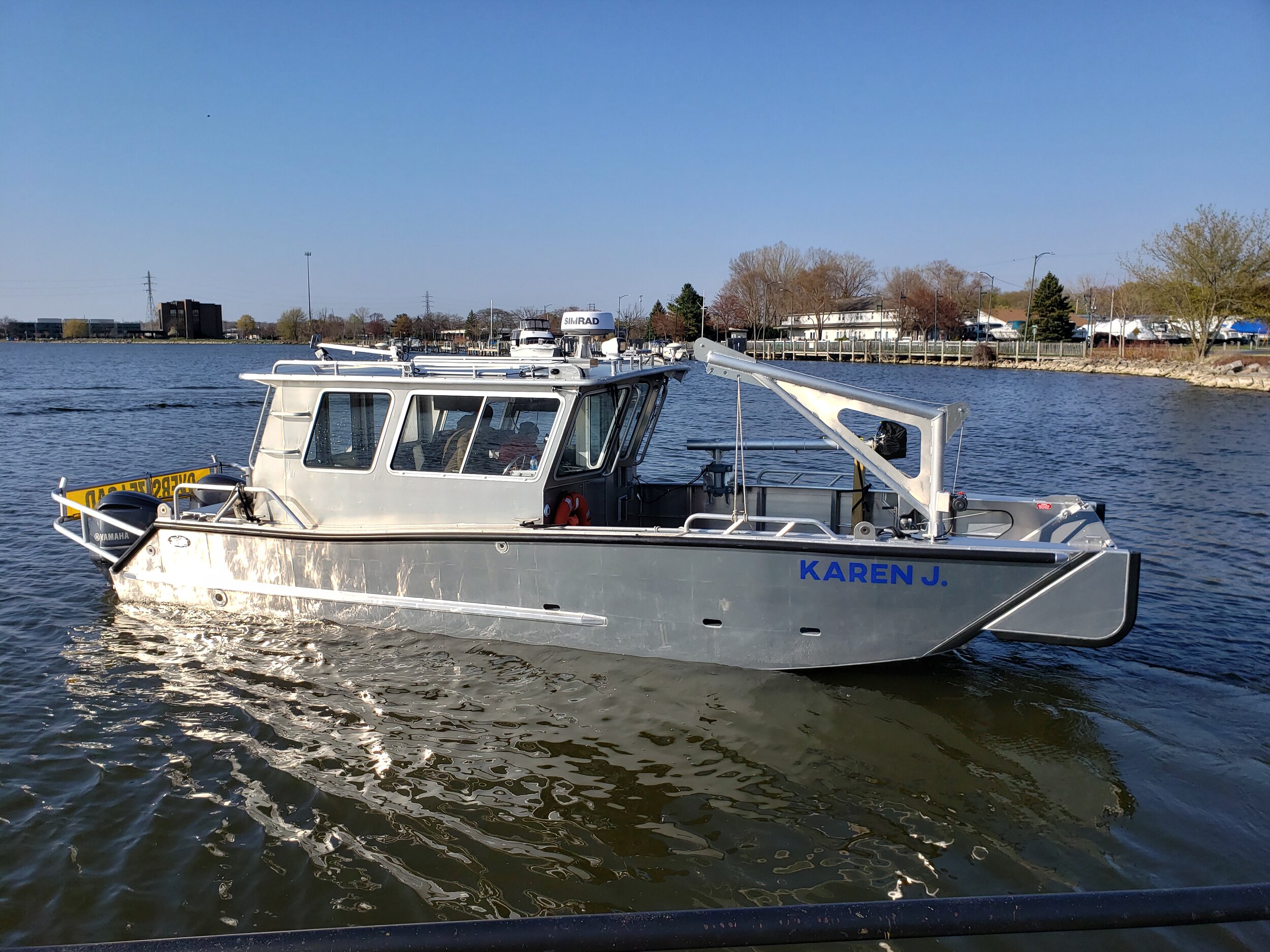
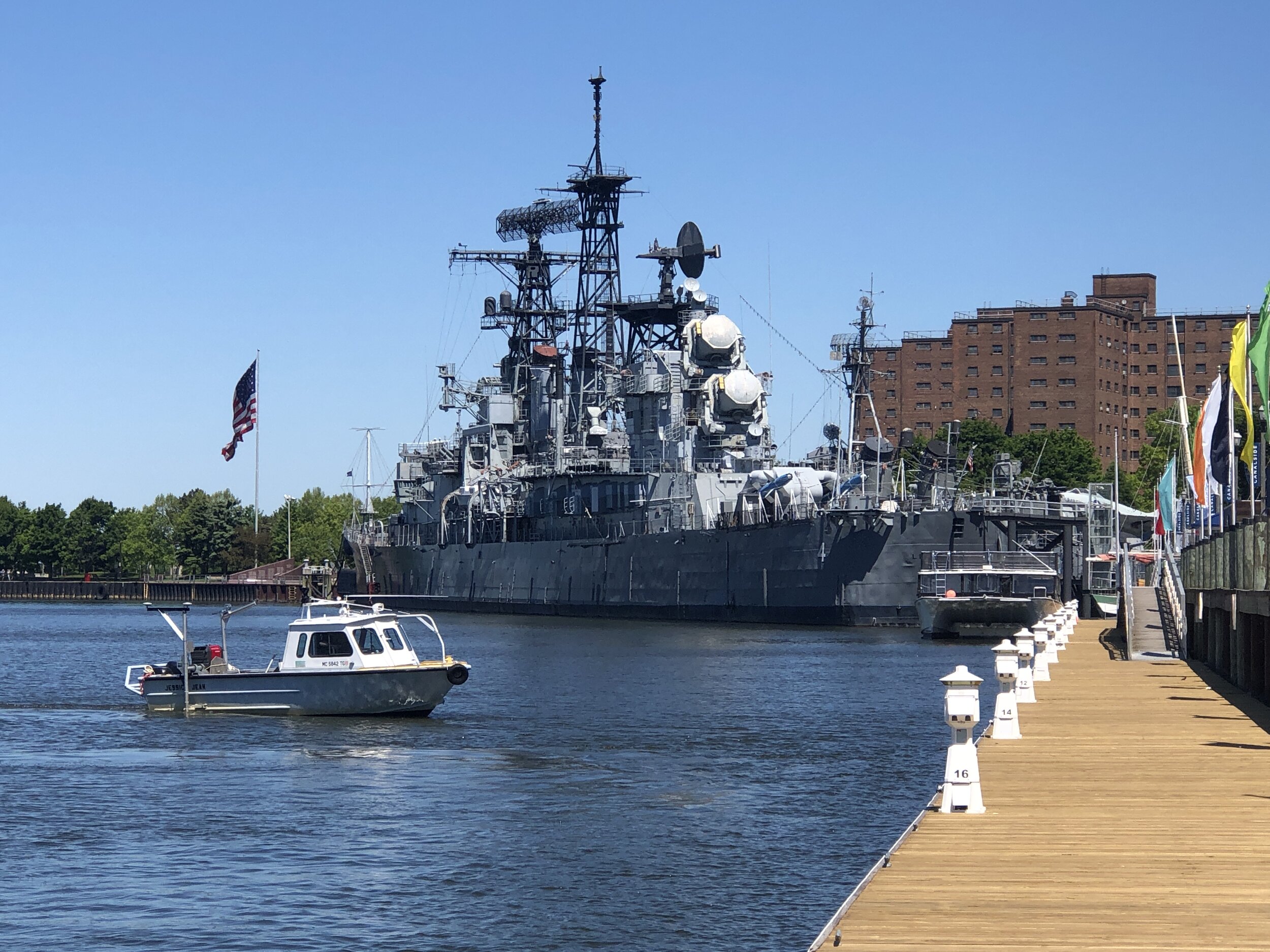
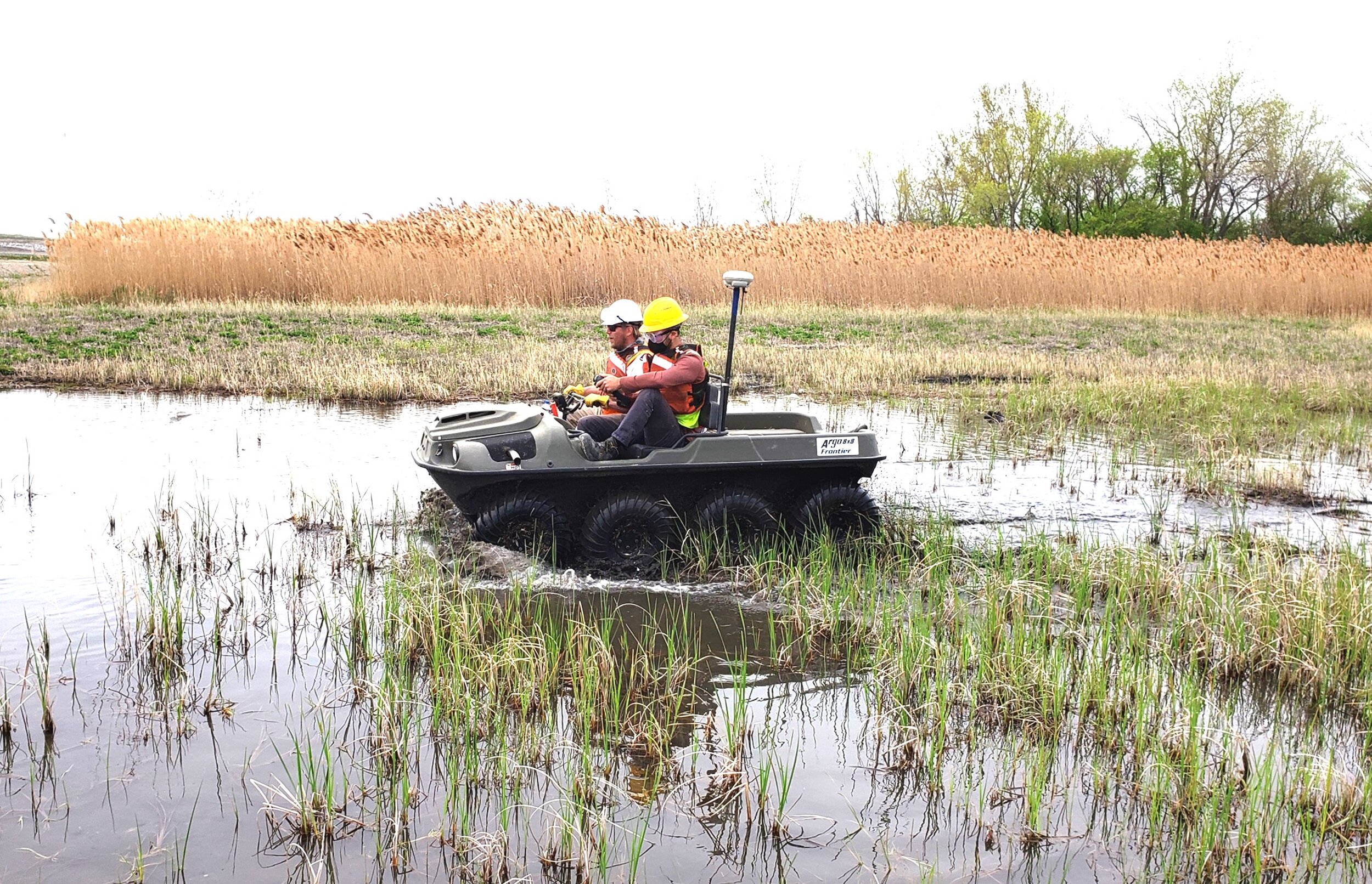
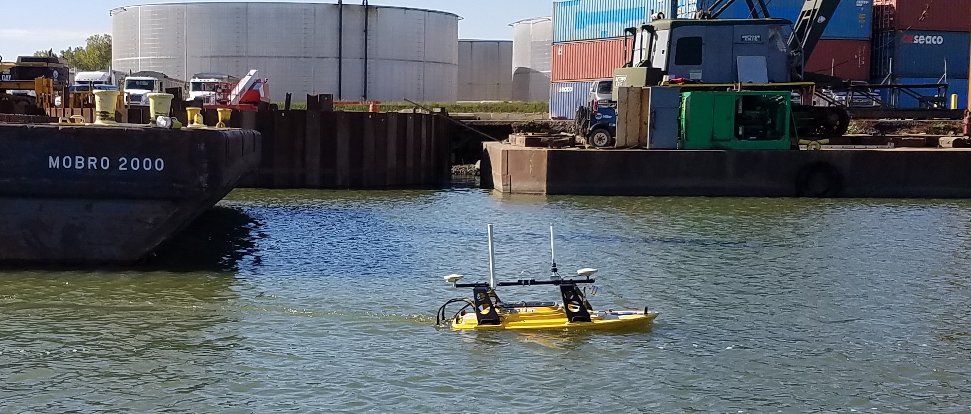
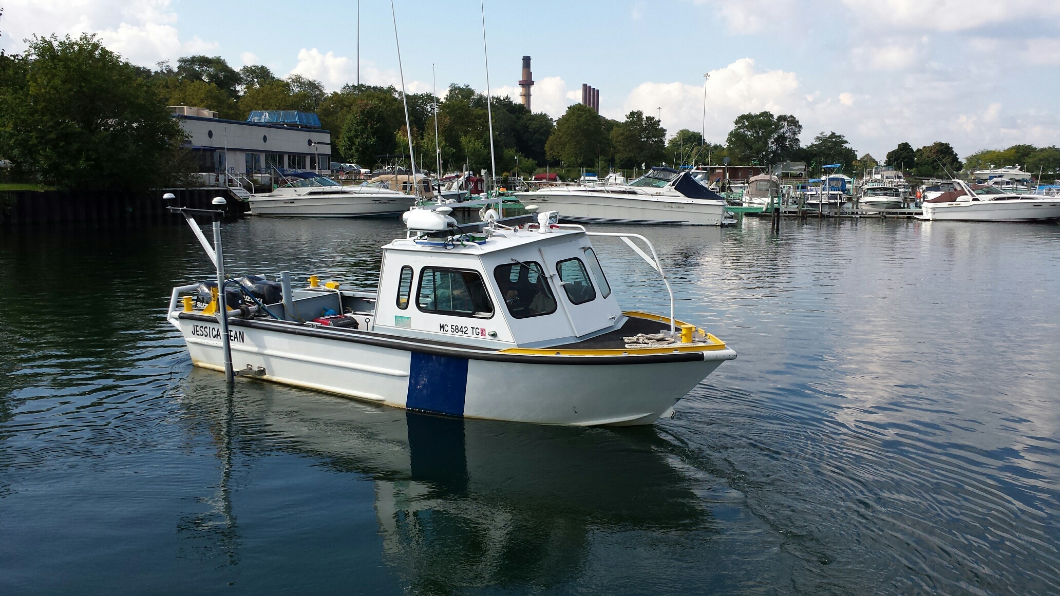
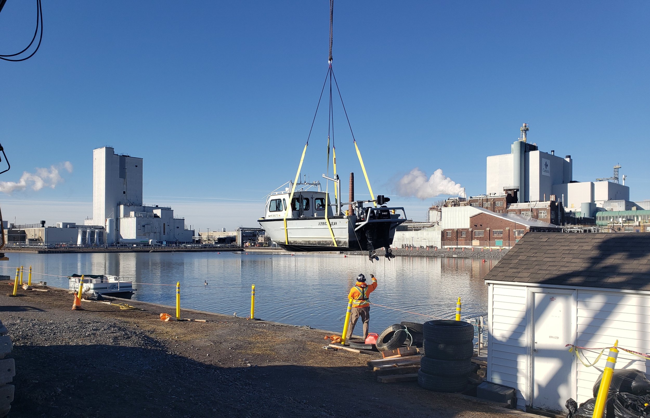
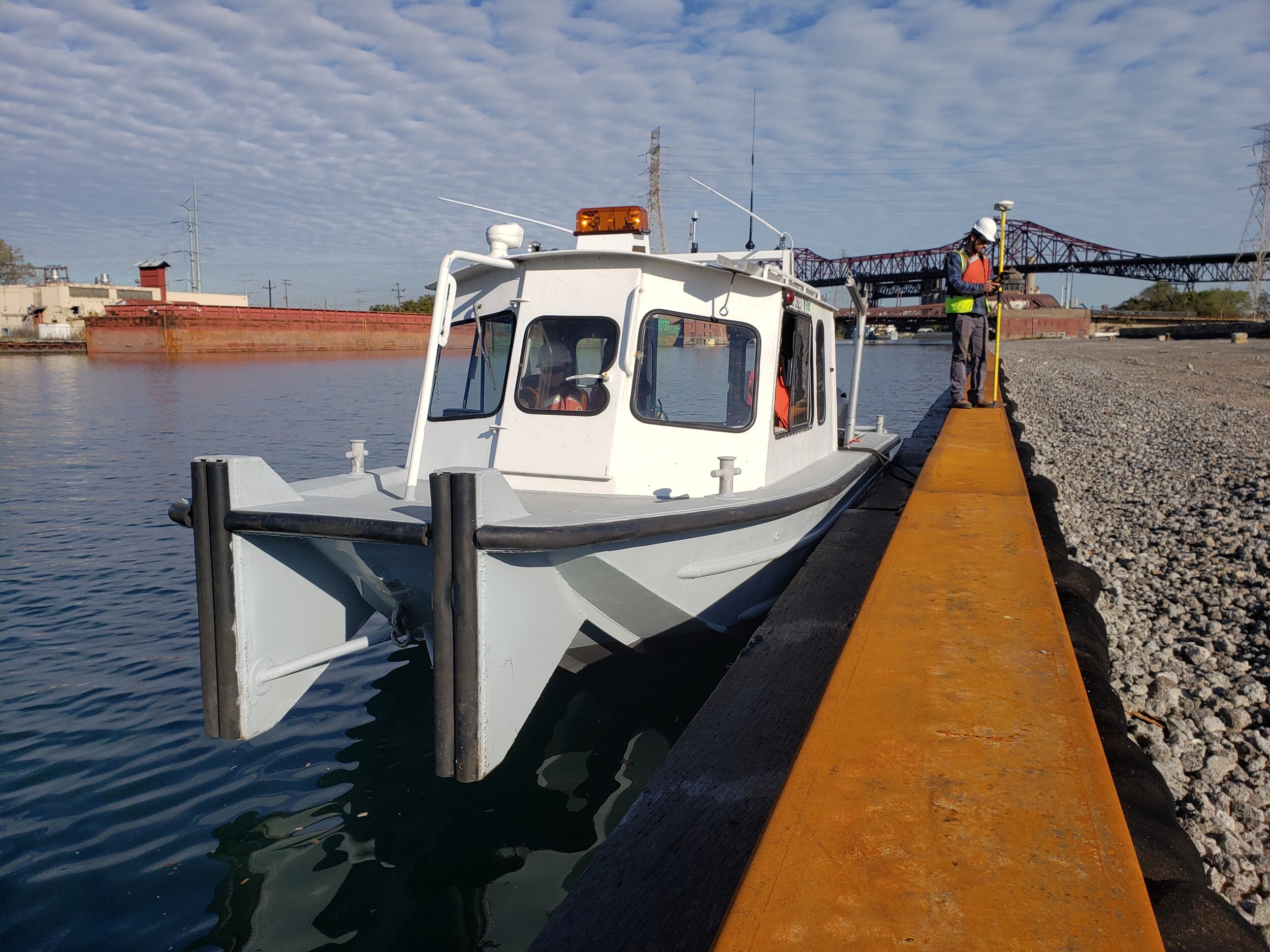
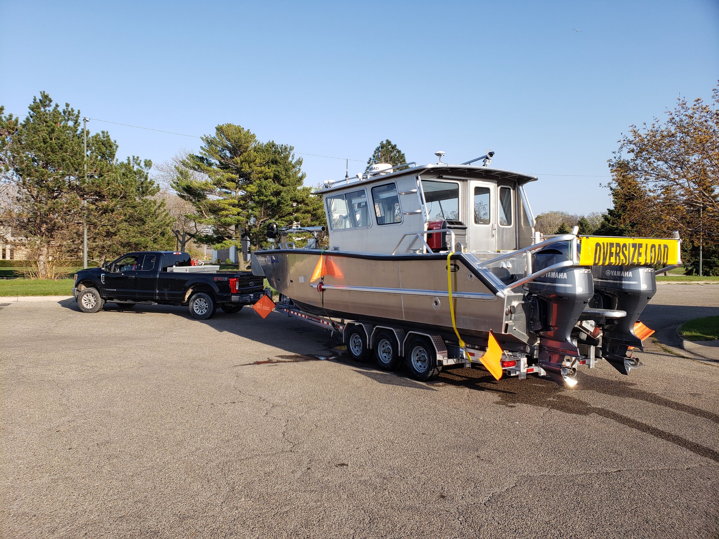
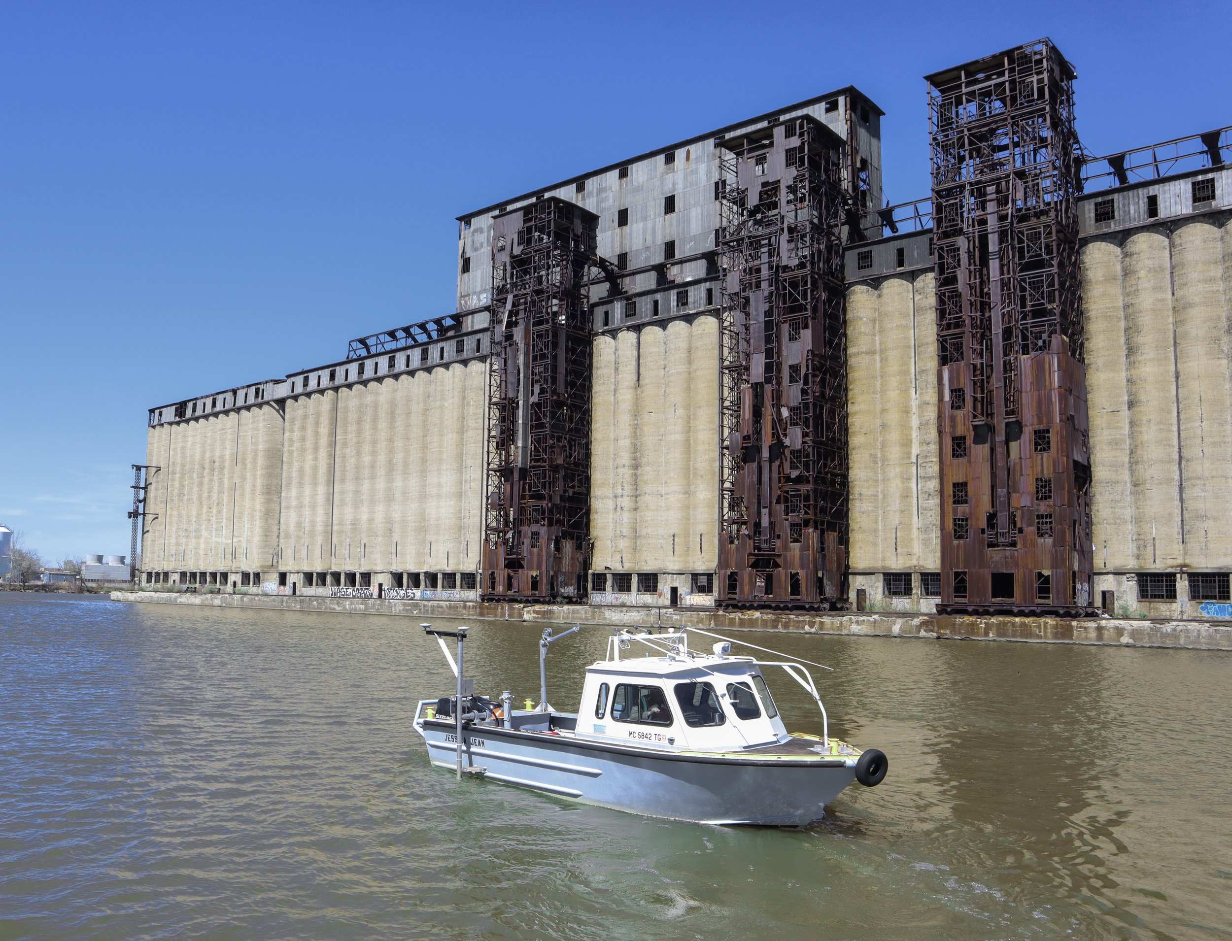
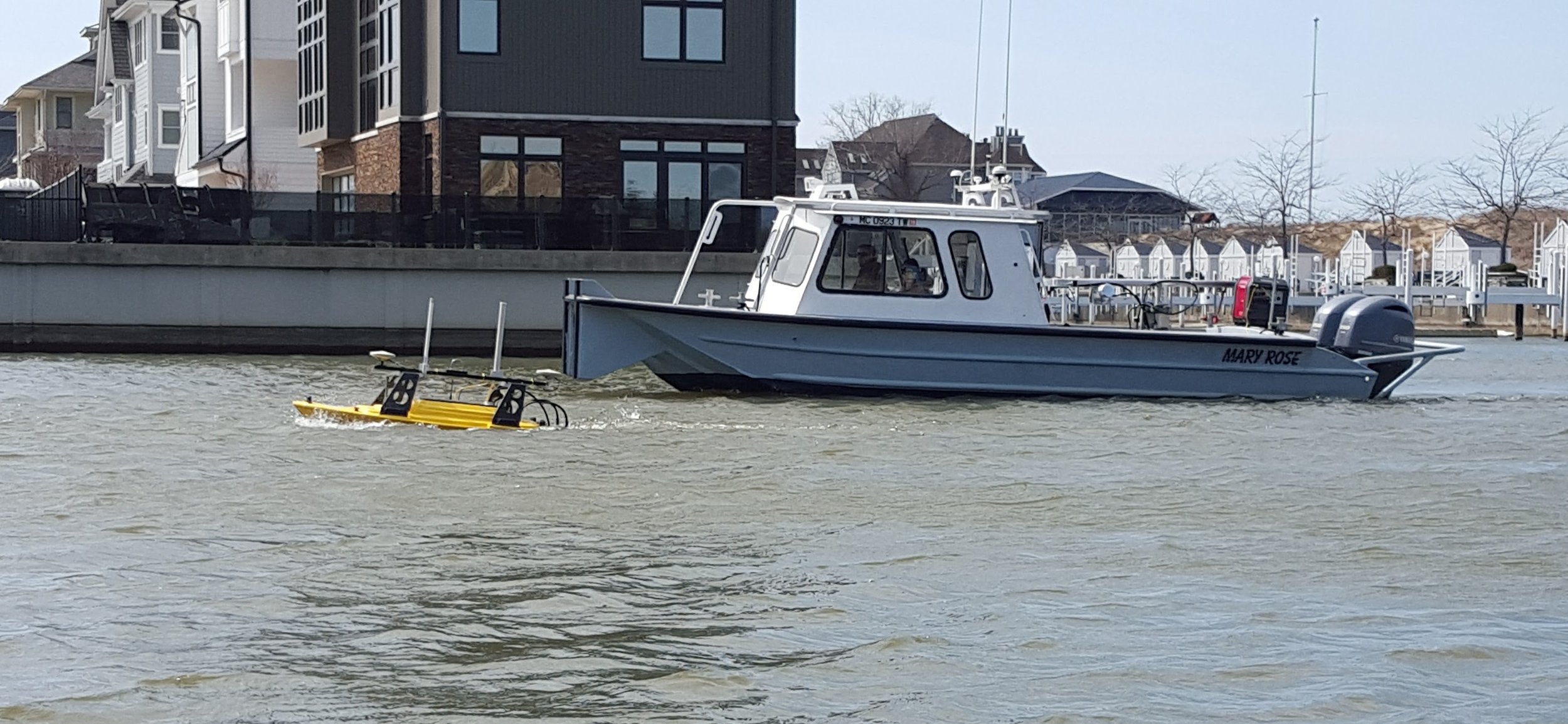
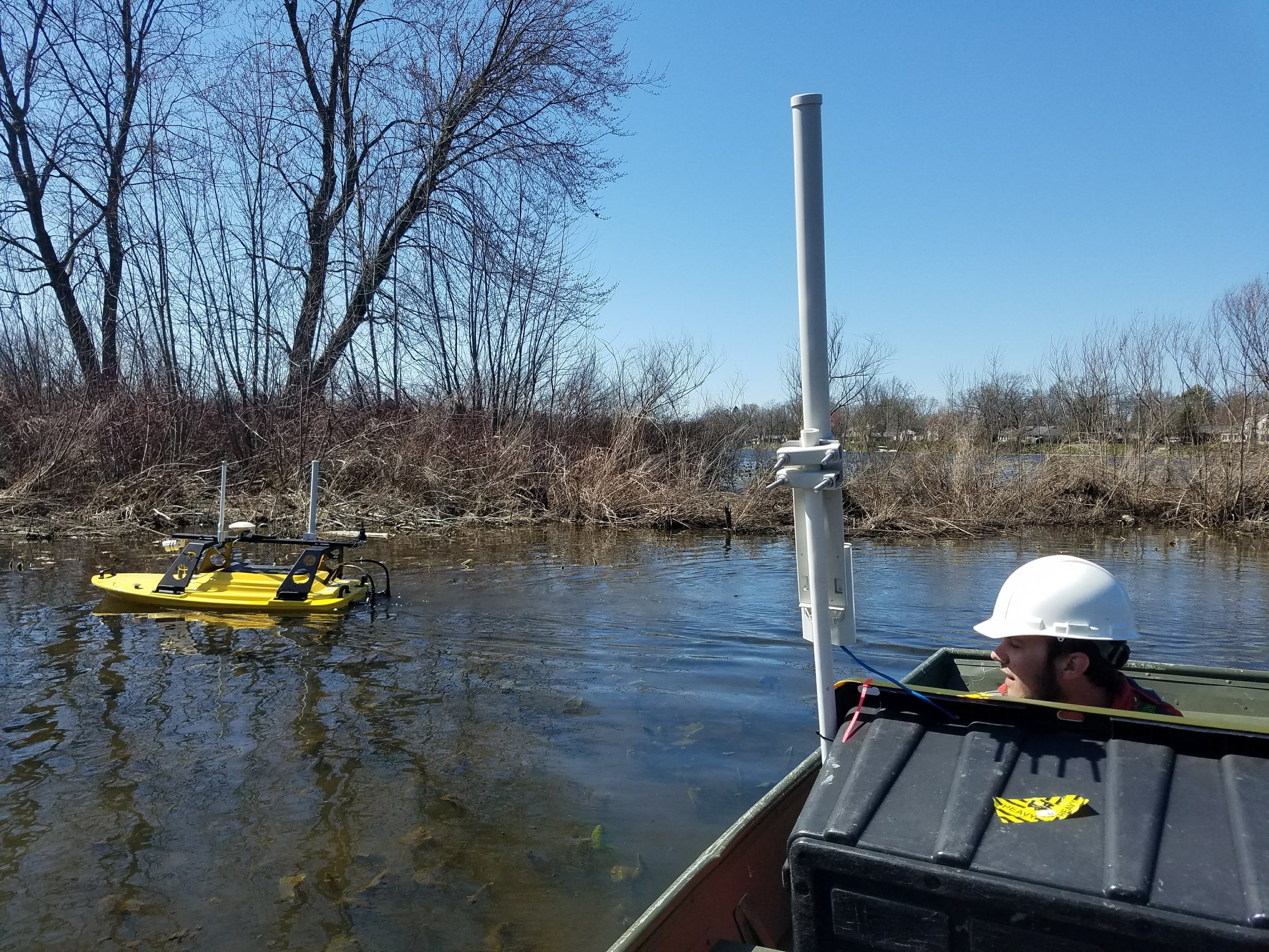
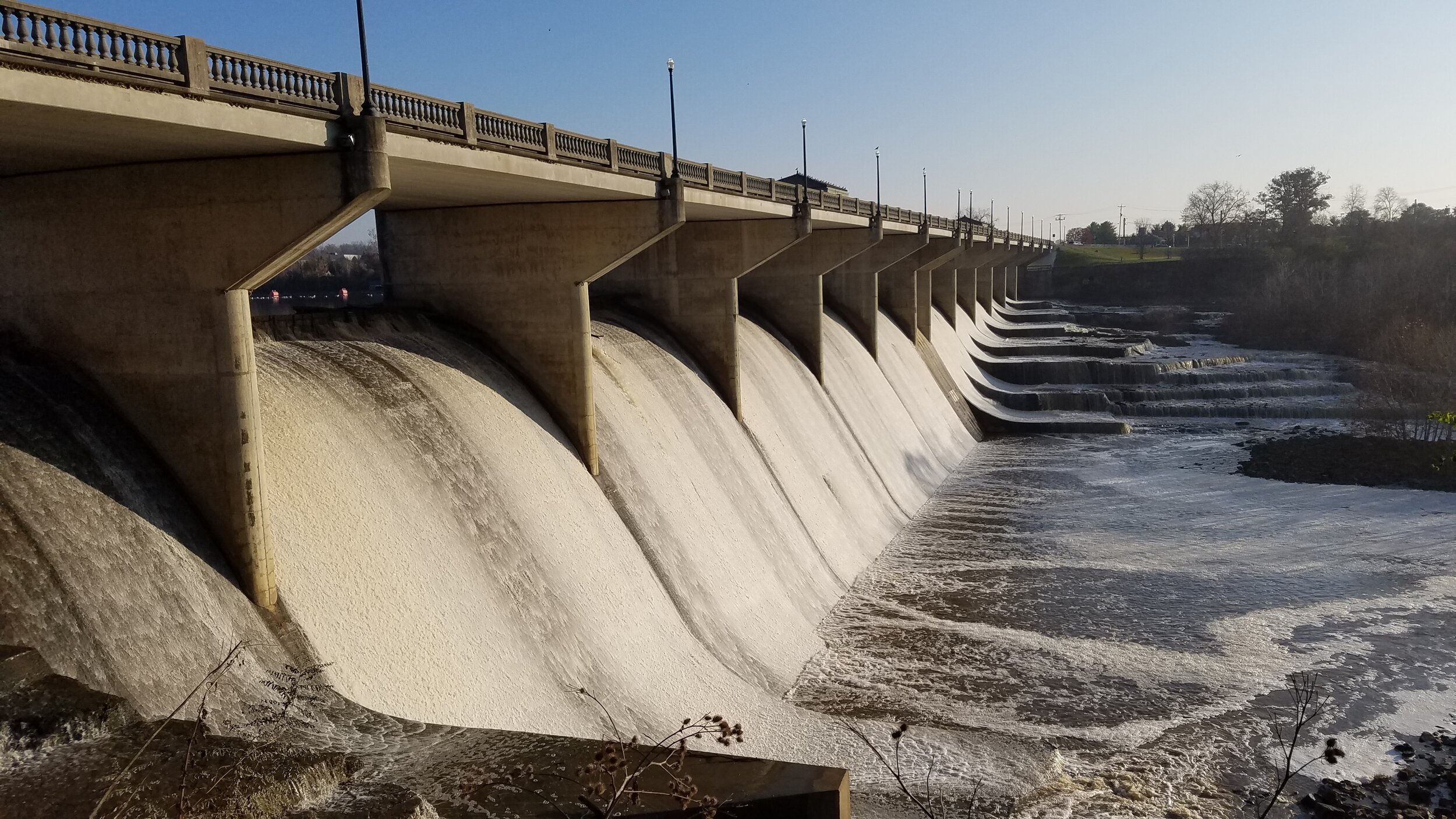
Seaworks’ investment in equipment includes five aluminum cabin survey vessels, a portable Z-Boat drone, multiple ROV’s, an amphibious 8x8 vehicle, and several smaller support boats. All of this ensures we have the capacity to take on any marine project, large or small.
Image Gallery